Sunday, May 23, 2010

Canyonlands National Park, in Moab, Utah

Canyonlands Nat'l Park is divided into three sections: Island in the Sky, The Maze and the Needles area. We went to the Island in the Sky area, outside of Moab.

The picture below is of Upheaval Crater. There are several theories as to how this crater got here. One is that millions of years ago a meteor crashed into the plateau.


This area is in the heart of the Colorado Plateau. The Green and Colorado rivers helped carve these canyons.


The picture below is of Mesa Arch. This was an easy one mile hike to see. It was worth the time to see this one accessible arch within the parks overlook areas.


See ya down the road !

Arches National Park, in Moab, Utah

This park lies atop an underground salt bed that is basically responsible for the arches, spires, balanced rocks, sandstone fins and eroded monoliths of this fantastic park.


We came to this park to, of course, see the Arches. We did not leave disappointed.


The picture below is of the windows arches. As you can see they look like windows........


Some hikes are longer than others to get to see the arches, but all are truly worth it!


The picture below is of Delicate arch. We hiked the day before to the arch. We forgot our camera so we had to go back the next day and go to the lower level to look up to get the picture of the arch. It was a great hike, difficult for me, but I am SO glad that I did it. Well worth it.


The picture below is of Landscape arch. A huge chunk of this arch fell in 1991. It was 60 feet long and ll feet wide and was 4 feet thick. Since then they closed the area to visitors walking under the arch. This arch is 306 feet across. Hard to tell from a picture isn't it?


It can get very hot on some of the hikes, so make sure you carry lots of water with you and drink it often. It would not be fun to get heat stroke and miss out on your visit to the Arches.


See ya down the road !


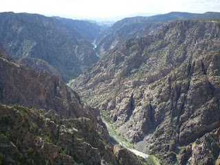
Black Canyon of the Gunnison, Colorado

The first written record of this gorge is from the Hayden expedition i 1873 which deemed the Black Canyon inaccessible.

The canyon is called "Black" because it is so deep (over 2500 feet in some areas) and it is so sheer and so narrow, very little sunlight can penetrate it.


By early 1900 the nearby Uncompahgre Valley needed river water for irrigation, so then began the idea of a tunnel goin 5.8 miles - called the Gunnison Diverson Tunnel - was begun. It still delivers water to this day for irrigation. It took five years to complete going under the mountains.


You can drive down the East Portal road, to the base where the Gunnison River is. When we were there the Crystal Dam was releasing water into the Gunnison and it was running very rapid. You can kayak down there with a permit as it is Class V rapids.


There are several overlooks with minor hikes to see the deep gorge.


See ya down the road !

Saturday, May 15, 2010

Capitol Reef National Monument, Utah

Capitol Reef National Monument is in Utah and we drove here straight from our trip at Bryce Canyon. We took scenic byway 12 north and it was an awesome drive. When we arrived at Capitol Reef we went directly to the visitors center and then took off in our truck to see the sights. The park is 378 square miles of colorful canyons, ridges, buttes and monoliths. There are also a few petroglythes that have been found.


In the early 1880's settlers moved to the Capitol Reef Country. By 1920 work was hard but life was pretty good. No more than ten families at any given time lived there.

We stopped and got out several times just to look at the scale of the mountains compared to our truck. It was a sight to see - just look at the picture below.


Every where we turned the sight we saw was more awesome than the last. The colors were stupendous.


We took the truck down one of the roads into one of the washes to do a hike. We also saw some of the closed up uranium mines from previous mining throughout the years.


We love to hike whenever we can and as you can see from the pictures above and below, we are having a good time.


See ya down the road !


Friday, May 14, 2010

Bryce National Park, Southern Utah

Driving into and through Bryce Canyon National Park is jaw-dropping to say the least. This park is on the eastern edge of the Paunsaugunt Plateau.


Millions of years of wind, and water erosion has carved the limestone into unusual and unique formations.


These formations consist of spires, fins, arches and mazes.


When you see a rock formation with a smaller OR larger rock on top of it, this is called a "hoodoo".


There is not much more I can say about this beautiful place - except to say - " I wish you were here."


See you down the road !

Zion National Park, Virgin, Utah

Zion National Park is in the city of Virgin, Utah. When you enter the park you must pass through a mile long tunnel in the mountain. If your RV or motorhome is too tall you must pay $15 for an escort through the tunnel. If you are over a certain height - you can't enter the tunnel at all.


The rock formations here are beautiful and a true sight to see. There are many trails to hike and you leave your vehicle at the visitors center and ride the shuttle through the park. It has many stops to get off to go hike. There are also horseback rides in the park. We did it and it was lots of fun.

There is a very passive walk which is about one mile total which ends up at the waterfall that you see in the picture below.

Whether it is the ride into the park or on your way out of the park, every view is sensational.


One day, driving out of the park we saw some big horn sheep. Luckily I got close enough with my cameras zoom lens to snap a picture.


Also within the park are some petroglyths. Lucky for us we spotted the sign that lead to a short walk to view them.


See ya down the road.


Pipe Spring Nat'l Monument, Arizona

We drove today, after going to Coral Pink Sand Dunes, on US 89 towards Fredonia, Arizona where we entered the Pipe Spring National Monument. The visitors center has loads of information about the Piute Indians and their lives. Also there are a lot of photos and information about the families that originally lived at Winsor Castle as it was called.

Pipe Spring was discovered in 1858 by a missionary on an expedition to Hopi mesas. In the 1860's a mormon pioneer brought cattle to the area and a large cattle operation began. In 1872 a protective fort was built over the main spring they discovered.


Winsor Castle was so named because of the first cattle ranch manager whose last name was Winsor.

A corral with horses and Texas long horn cattle is also on the premises.


This was also the first original telegraph in the state of Arizona which was established in 1871.

This is an example of how the Piute Indians lived in this area.


This is an original buggy and how the family got around the area pulled of course by horses.


There is also a short hiking trail and fruit orchard around the house grounds.

See ya down the road !

Thursday, May 13, 2010

Coral Pink Sand Dunes, Kanab, Utah

We arrive in Glendale, Utah and set up camp at Bauer's RV Ranch. This is a great place. The owners are extremely friendly. It is about 10 miles from the entrance to Zion National Park


I think this little snow episode happened on the second day we were there. We really enjoyed our stay here. Before we went to Zion, we went to the Coral Pink Sand Dunes in Kanab Utah.


The beautiful salmon colored sand is so fine. It was a sunny day and we were able to walk lots of the dunes.

Here Jeff is walking out on the dunes with our friends, Rob & Jane, who we are traveling with.


This area also allows ATV's to cycle around but they have designated trails they must go on.


See ya down the road !


Horse Shoe Bend, Page, AZ

On US 89, outside of Page, AZ is Horse Shoe Bend. As you can see there is this giant rock-island in the middle with water all the way around and it looks like it is in the shape of a horse shoe.


I am not much on the 'height' thingee and Jeff knows it, so as I get near the edge, I sorta start to panic but Jeff is in control and take care of me......... ha ha ha.........


This is such an unusual site and you have to hike about 1/2 mile from the road to see it.

The rock formations here are so unusual. I never tire of looking at them.


See ya down the road !