Saturday, July 31, 2010

Mount Ranier National Park , Washington

Mount Ranier is another one of the active volcanoes in Washington. It stands 14, 410 feet in height. Mount Ranier was established in 1899 as a National Park.

There are 26 glaciers that cap the mountain. The mountain is close to the western edge of the North American tetonic plate. The mountain we see today is relatively young in geologic terms: it formed about 500,000 years ago. Like Mount St. Helens and other Cascase volcanoes, Mount Ranier has the potential to erupt again at some unknown time.


We drove inside the park to the visitors center in Paradise. We saw a nice film about the park there and attempted to hike to a waterfall. But as you can see in the pictures below the trails were still snowed in. We attempted to find it but all we found was the information sign buried under about 5 feet of snow.


Later we hiked a trail that took us over this suspension bridge. I don't like walking on these things but this one wasn't too bad.


We drove along the highway inside the park to Reflections Lakes. There are 2-3 lakes together here. The picture below is from the largest one. This is a picture that is taken by everyone who comes here and I am sure you have seen it on TV or a card somewhere. This is an infamous spot to take a picture, so it is very, very popular.


Later we hiked another trail that took us to this small waterfall. Still very pretty though.


On one of the trails this huge tree had fallen and I did my best to upright it, but I just couldn't do it !


Further down the lane, Jeff tried to upright one in his own fashion, but that didn't work either!


We hiked over a bridge to look 180 feet below at this beautiful gorge. The scenery getting there was just wonderful.
When we look back at pictures we have taken sometimes it seems just too good to be true.


Looking over the edge of the bridge or walking over to the edge of the gorge itself reveals the water flowing rapidly below and also just how deep this gorge really is.


See ya down the road !


Friday, July 30, 2010

Iron Creek Campground, (NFS) Washington

After we left Mt. St. Helens we were headed to Mt. Ranier but we decided to take a day or two off and just rest. I came across the camping area below which was between the two parks.

It is south of Randle, Washington, on Forest Service Road #25. We found a great spot. It is $20 a night for no hook ups. The sites are large. Road is paved and so are sites. They have picnic tables and fire rings. It is right on a river (our site wasn't) and there is a hiking trail within it that is 1.5 miles and one nearby that is 2.5 miles.


The picture below is of the river that our campground was situated at. You could tube down it, fish on it or just look at it !


During one of our hikes I took this picture of Jeff. As you can see this forest is very lush and green. In this picture a tree had fallen and Jeff is standing in front of the gaping hole in the ground.


I was amazed at how big these leaves were. Look at the size of my hand in comparison to the leaf.


This marshy area was on the way to the trailhead we hiked near the campground.


See ya down the road !


Thursday, July 29, 2010

Mount St. Helens, Washington

In March 1980, after 123 years of silence, Mt. St. Helens resumed volcanic activity. The mountain blew a 5.1 magnitude earthquake which triggered a violent eruption and one of the worlds largest recorded landslides.


Upon entering the park, I encountered this beautiful flowering plant. I don't know its name but it was too beautiful not to pass along to you.


Thirteen hundred feet of mountaintop collapsed into the Toutle River Valley. This eruption claimed 57 lives and devastated almost 150,000 acres of forests.


The valley below the mountain was instantly scoured by heat, wind, ash, & rock. Winds reached over 300 miles per hour & the landslide reached speeds of 155 miles per hour. The temperatures reached 660 degrees Fahrenheit.


The landscape was left barren after the blast and all was grey with ash. All trees were flattened. The ground itself was stripped of any grasses, down to its topsoil. It was down to the plan rock foundation.


The park has left its portion of the devastation in tact. But Weyerhauser, who has tree farms adjacent and around the park, planted over 18.4 million trees to replace those lost by this explosion.


Since 1980, plant & animal life has come back to Mt. St. Helens and the surrounding valley.

From October 2004 through January 2008 the ongoing 'minor' eruptions produced over 125 million cubic meters of lava.


There are several hiking trails that you can take, and be sure to visit the Johnston Ridge Observatory and the Forest Learning Center. They show short movies and tell stories of before, during and after the May 1980 eruption.


See ya down the road !


Columbia Gorge from Troutdale, OR

We leave the coast of Oregon and head inland to Troutdale, Oregon to begin our visit of the Columbia Gorge area. We start our visit by traveling along the scenic byway, Route 31.

We come to Vista House at Crown Point which is 733' above the river. The house was built in 1917 and was recently renovated. It has beautiful view of the gorge and of the Columbia river below. The two story structure is 44' in diameter and 55' high.


We continued our drive until we reached Multnomah Falls which you can see from the roadway.
The waterfall is 620' in height. It is a short walk to get closer and a little further you can walk and view the falls from the bridge you can see in the pictures below. The bridge we are on is called the Historic Benson Bridge which was built in 1914. There is also a lodge on the premises, but no rooms to sleep in - only two dining rooms for customers to use.

We went to the Columbia Gorge Interpetive Center which is across the Bridge of the Gods from Oregon to Washington (cost $1.00 each way). Admission is $7.00 for an adult and it is well worth the price. There are two movies to watch. The purpose of the facility is to preserve, conserve, exhibit and interpet the cultural & natural history of the Columbia River Gorge.


Logging is a big part of the facility, also Indian history for the area, worlds largest Rosary Collection, and a Mccord Fishwheel Replica. Below is an example of how the indians would use a net from a platform to scoop up Salmon.


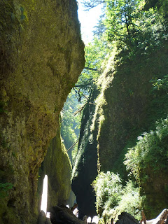
One of the hikes we went on was the Oneonata Gorge and falls Hike. This is through the gorge and the narrows.


Beliw is a picture of Jeff climbing over some logs to get to the area ahead. When he got there it was three feet of water to tread through to see the other side of the gorge area.


As you can see, it is really beautiful there.


We also went on a hike to Horsetail falls. We crossed a wooden bridge and the elevation was moderate. It was about two miles one way through the tall trees which kept us fairly cool.


Below is a picture of the waterfall once we reached it.


See you down the road !


Seaside, Oregon

Continuing our trek north on Hwy 101, we land in Seaside, Oregon. The ride was beautiful and the seaside cliffs are a sight to see.


We took a stroll to the promenade in town and saw this guitar panhandler/entertainer there.


We took a stroll over to the sign that indicated the end of the Lewis & Clark Trail.


This is the statue erected of Lewis & Clark on the Promenade.

You can see this is a busy, touristy type of town.

This is a scene from the beach area along the promenade. There are lots of hotels and still some private homes on the beach front also.


We drove along the coast to look for a lighthouse we had heard about that is on an island offshore. As you can see the scenery was just beautiful as seen in the picture below.


Below is a picture of a lighthouse which is on an island and from what I am told the lighthouse is privately owned. Also it is said that the owner allows loved ones to dispose of the ashes of their loved one on the island if they wish for all eternity!


See ya down the road !

Friday, July 16, 2010

Tillamook, Oregon

We are now in Tillamook, Oregon and still on Hwy 101. We visit the Cape Mears Lighthouse which is on the scenic loop drive.

Recently two teenage vandals with shotguns vandalized the windows and lens of this lighthouse doing some $500,000 in damage.


We later visited the Tillamook Factory.

It was fascinating to see how the cheeses are made and packaged. On the other side of the factory is where they make the ice cream. We, of course, had to have some and it was great!

This factory is over 100 years old. Please visit it if in the area, you won't be sorry.


Up at the lighthouse parking area, there was a short trail to the Octopus Tree, which is believed to be 200-300 years old. It has no true base, the limbs just seem to pop out of the ground.

The picture below is from the grounds of the lighthouse. As you can see it was a very foggy day. Not unusual at all for the Oregon coast. Most of the time though it seemed to disappear by mid day.


The next day we went to the Naval Air Museum. Originally this building was built to house the WWWII air ships. (also known as blimps) These air ships were used to guide in ships to harbor and also to be on the look out for enemy planes or ships.


The inside of this building is made completely out of wood from the Washington and Oregon states. As steel and rubber products were at a premium during the war, this building was an architectural feet for its time. The outside is coated with steel to protect the building.


Inside the building houses some of the more interesting planes. Some of the planes are war planes and some are not. There is also a movie which shows the construction of the building which was very interesting.

See me inside the training cockpit of one of the planes. It is a tight fit - don't know how those men did it !

Look at the beautiful art work that was painted on to the fighter planes. Interesting names and drawings were on several planes there - I can't post ALL the pictures - as some of the ladies were scantily clad - to say the least !


See ya down the road !